| The Village of Euxton, Lancashire, England. |
 Euxton dot com ™ |
| The Village of Euxton, Lancashire, England. |
Euxton dot com ™ |

| Euxton Village maps: Home Page |
Euxton Hall Euxton Village - A49 |
Yarrow River Chapel Brook to Culbeck |
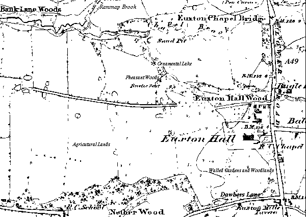
Euxton Hall.
Map (circa 1850).
Euxton Hall
map features shown include: |
|
Historic Euxton Hall |
| Euxton Village maps: Home Page |
Euxton Hall Euxton Village - A49 |
Yarrow River Chapel Brook to Culbeck |
|
| The Village of Euxton, Lancashire, England. |
Advertising,
Listing & Marketing Inquiries with Euxton dot com ™ are welcome
© Copyright Euxton
dot com™ All Rights Reserved Worldwide
Users of this web site are advised to
see our Disclaimer.